
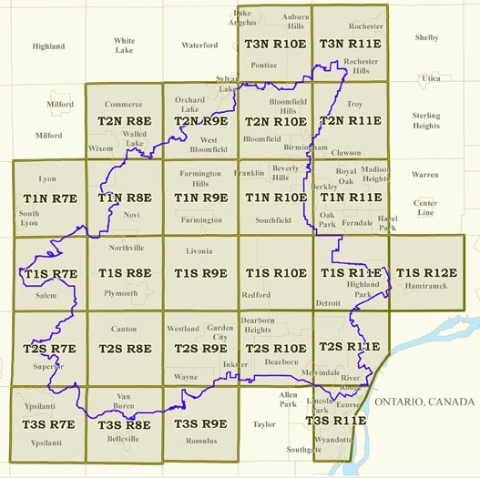
Surveyors are assigned a quarter square mile block within the watershed. The blocks are based on the Land Survey system that divides the state into 36 square mile townships. Each survey block is identified by the Township (ex-T1S), Range (ex-R8E), section number (1-36), and quarter section (NE=1, NW=2, SW=3, SE=4).
 Surveyors identify the available wetlands within that area and survey all many as are reachable each time they survey.
Press on the graphic of the Townships to see an enlargement. A map showing the survey blocks and data can be also be viewed.
Downloading Maps
To download your survey map, refer to the map on the left and choose your township, then click on the township link to open the page. Each township page (example – Farmington T1N R9E) will have all the block maps.
Oakland County
Wayne County
Washtenaw County
Categories
-
Our WorkShort description about the category for context.